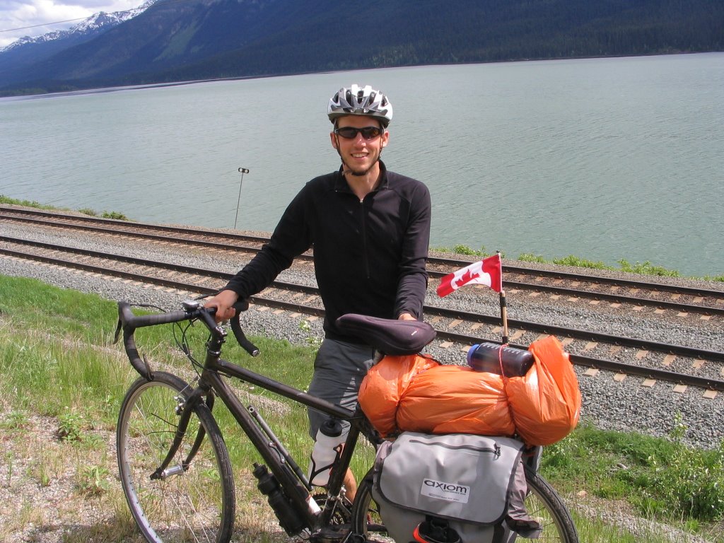
After completing the first leg of my journey and gaining some experience on by Canondale touring bike I was ready to have a look at the big picture. It was time to meet up with my biking companion Cameron Jinks and head out East climbing up and over mountain ranges through river valleys to the expansive great plains of North America. The map of British Columbia is indeed quite daunting to look at from a bikers viewpoint. Mountain Ranges getting progressively taller until hitting the Rockies and the continental divide on the Alberta border which sends rain falling on the BC side west Via the Fraser or Columbia rivers to the Pacific Ocean and the rain falling on the Alberta side to eventually reach the Atlantic Ocean or atleast Hudsons Bay.
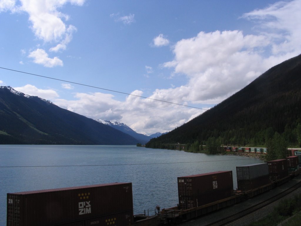
Being that I am quite familiar with the route from Calgary to Vancouver after passing it countless times and having done a couple of solo wilderness treks in Glacier National park and Yoho national park I decided to take The #5 Yellowhead Highway north. The Yellowhead, an old road but new to us, heads north east from Hope BC over the treacherous Coaquialla mountain pass (1244 m) down into the Merrit Valley before climbing even higher to the Surrey lake mountain pass (1440 m) an even higher but less extreme road. Eventuallly hitting The North Thompson River which meanders through a calm scenic valley several hundred kilometers north east right to the edge of the Rocky Mountains.
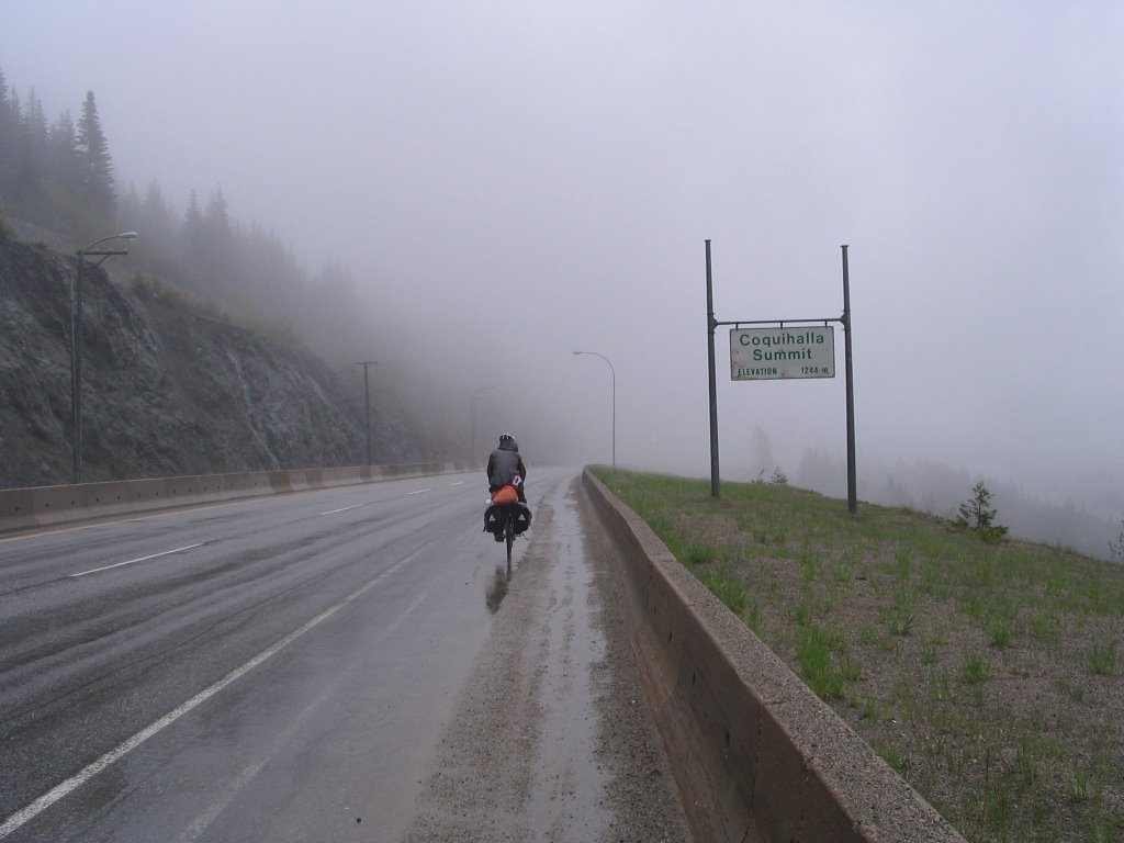 Over both of these mountain passes we encountered absolutely terrible weather, not quite snow but frigid rain driving into our faces from the wind. The coaquialla was a steep and long ascent from Hope down near sea level at the head of the Fraser Valley. We climbed for hours at 6-8 km/h along a poor excuse for a shoulder, really just a foot and a half of loose gravel with a stream running through it, all the while semi trucks roared past us spraying up tsunamis of thick mist until we reached the snow level near the foggy summit. But please don't get me wrong, this is where it got difficult. Exhausted at the summit we breaked for a snack and to snap a summit photo. Rapidly our body heat from the climb diminished as we layered up in warmer clothes to start the cruise down. As we gained speed down the rough shoulder we got wetter and colder. Huge puddles and streams were sprayed all over us as our tires span faster and faster, aided by the hard winds and cold rain we started to get cold, really cold. Our clothes and gloves being totally soaked provided little insulation. Cruising at 50 kilometers an hour fingers and feet numb and barely seeing through my mud plastered sunglasses it was not the glorious down hill ride I had hoped for but I still loved every second of it. We stopped for hot chocolate and shelter at a rest area but
 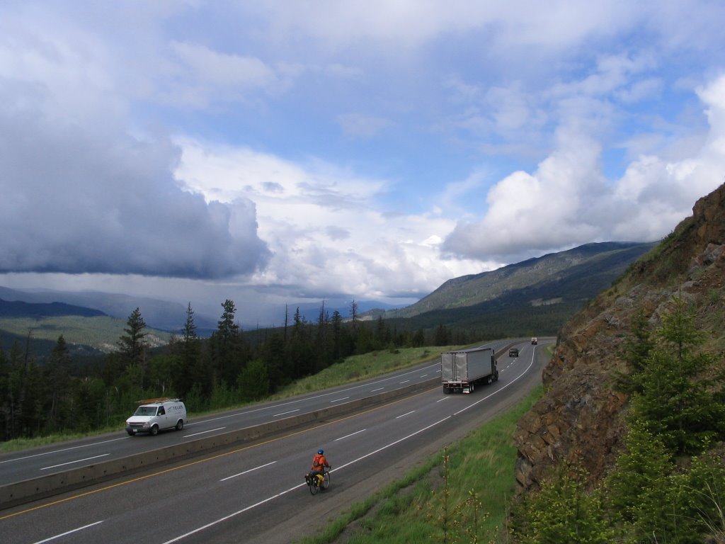 couldn't warm back up so we continued downwards into progressively warmer weather until finally after hours of slowly dropping elevation we rolled into the warm sun of the Merrit valley. The next day we did it all again on route to Kamloops via the Surrey Lake Summit even higher at 1440m but the shoulder was considerably safer and the weather much less severe but still very numbing especially on the feet and hands. At that end of the day we had such a magnificent 23 km down hill from the mountains into the Thompson river valley maintaining speeds between 60-65km/h through much of it.
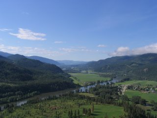
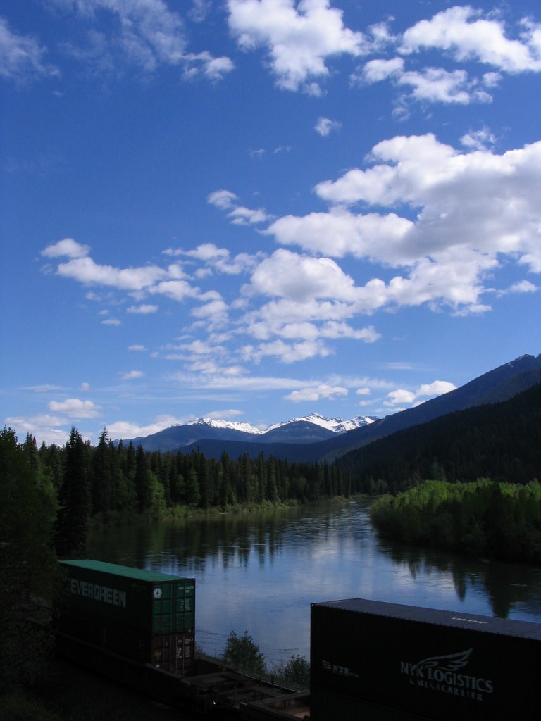 We took our first rest day in Kamloops staying in the Sage Brush Motel because the hostel was closed. After being wet for four days we splurged on the motel and ate lots of food and drank lots of beer. From Kamploops we were rewarded with a scenic three day ride up the North Thompson river valley, neither to many hill nor to much rain just nice easy riding with beautiful views all around. We followed the river north still on the Yellowhead Highway as it dwindled from a huge flow to just a trickle until going over a pass and being right back on the Fraser river.
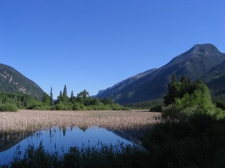
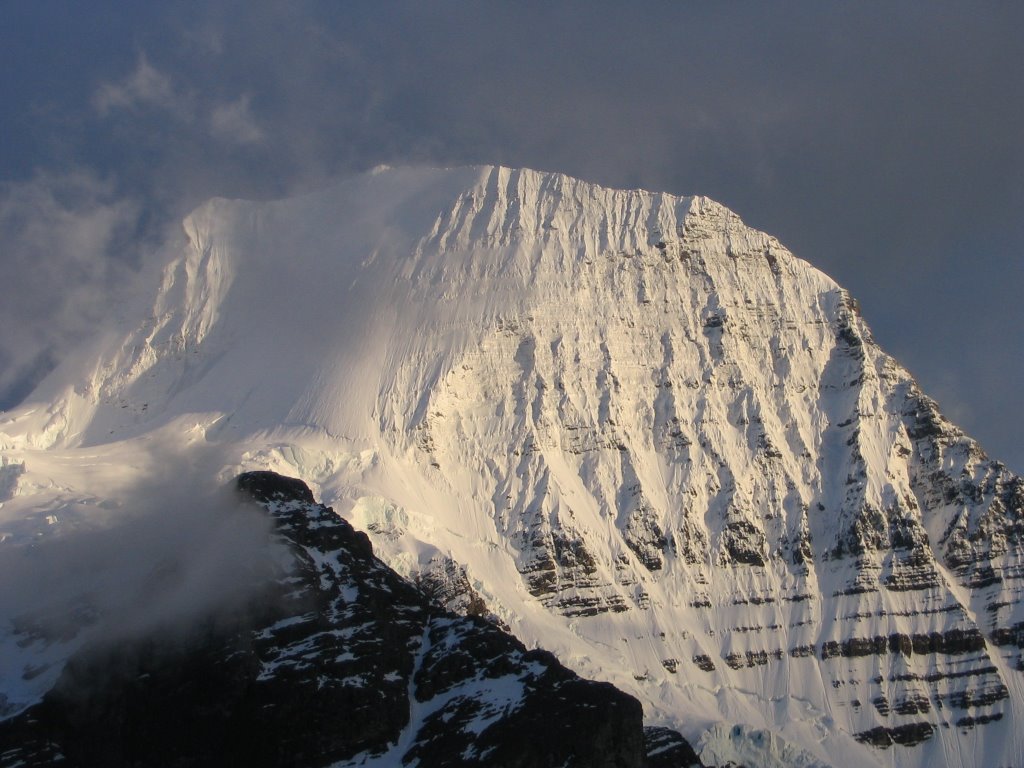
From there we entered the Rocky Mountains following the Fraser River valley up to Rearguard falls, notable not because of its size or beauty but because it marks the farthest point of the Pacific salmon migration. The strongest salmon swimming from the rivers mouth at Vancouver upstream over 800 miles to finally reach the end to lay their eggs and die. Soon after the falls as we rounded a blind corner an incredible mountain tower came into view. The Mount Robson massif, highest in the Canadian Rockies standing just under
 4000m. As usual the peak shrouded in clouds but still an impressive face of vertical rock to be seen. As we approached it on a long down hill cruise it grew taller and more impressive until we arrived at the visitor center just a few kilometers from the base of its Southern face.
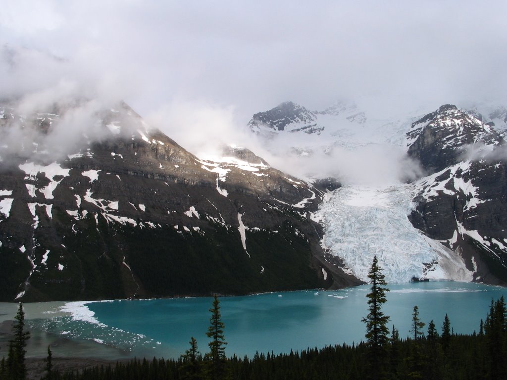
Inside the Visitor center we purchased backcountry permits for 5 dollars a night, as my plan the whole while was to hike around to the Northern side of the mountain to the appropriately named Berg Lake where the views were supposed to be the best. The hike up to the lake was pure ecstasy. The whole while passing through epic scenery, everything was on a grand scale huge cliffs towering all around with waterfalls pouring off them, gravel flats stretching off the tourquoise lakes. Chopped up glaciers tumbling down from the rocky peaks with milky creeks full off rock flour flowing from them around the knife edged morraines that mark where the glaciers once reached. When we reached the lake at 1640m it had a bold alpine feel to it ice bergs breaking off the glaciers in loud cracks like thunder, you could actually sit and
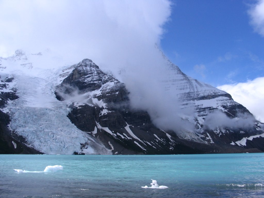
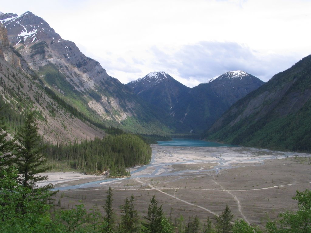 watch as pieces of ice sometimes as big as a bus would tumble into the waters below it. We still had not caught a glimpse of the summit which stood another 2300 near vertical meters above the lake. The skies could be blue all around but a forbidding dark cloud constantly swirled around the summit ruining our chance of a view and we began to worry that we would never see it. Finally on our second night as we drank tea on the front porch of the Heargreves shelter at the foot of the lake the skies cleared and slowly the forbidding dark cloud lifted until finally in the brilliantly sharp light of the low angle sun the peak revealed itself in all its glory. Definitely one of the most striking mountains I have ever seen and probably from that particular view at that particular time the most inspiring mountain view I have ever seen and believe me I've seen a
 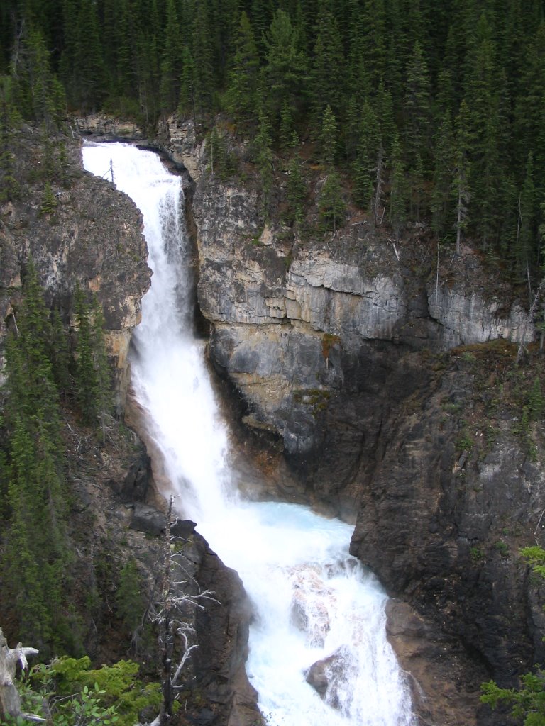 few.
few.After hiking out and saddling back up on our bikes, which were stashed off the trail in the forest as far as we could ride them, we were back on the Yellowhead following the Fraser River right to its source at Yellowhead Lake. Very soon after that we were to hit Yellowhead pass (1050m) which marks the continental divide and the Alberta border. Every trip I do in B.C. is a special one and many of my most beautiful and adventurous experiences traveling and exploring have been within its borders. I simply cant imagine a place that suits me more but I have so many places yet to see so here I go I'm off to try my best to find one.
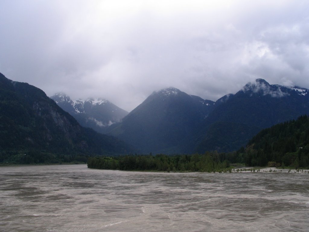
The North Thompson River Valley
#5 The Yellowhead Highway
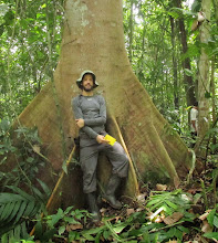
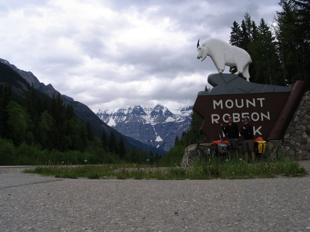
Mt. Robson Provincial Park
Mt. Robson 3994 meters, Highest in The Canadian Rockies

A

marmot in Mount Robson Provincial Park
Back on The # 5 Yellowhead Towards Alberta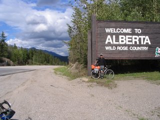
posted by Ira Sutherland @ 10:24 AM
0 comments
![]()